World Regional Maps Coloring Book


 Beschrijving
Bol
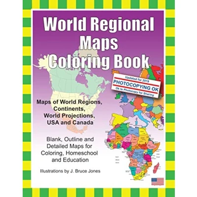
Learn and color blank, outline maps of the world and its regions with World Regional Maps Coloring Book. World Regions Coloring Book with blank outline maps is great for learning world regional geography, coloring, home school, education and even making up a map for marketing. Each blank, outline, printable continent map is presented with a detail version with political borders, country, capitals, major city names and country name, and then an outline map with just country names and a blank outline map without any of the information, great to color however you want. Students can trace the outlines of the map, study and highlight continents and features on the blank map. A great resource for students and kids.Black outline blank world maps included in the coloring book are: World Maps Robinson Projection World Maps Mercator Projection United States Outline Maps, with and without names Canada Maps, with and without namesWorld Regional and Continent Maps: Africa Map Asia Map Australia, Oceania Map Australia Map Europe Map Maps of North America including Canada, USA and Mexico South America Antarctica MapAdditional world regions maps included are: Russia Map Central America and the Caribbean Map Central America Map Europe to the Ural Mountains Map Eastern Europe Map Eastern Europe Baltic Region Map Middle East Map Mediterranean Regional Map Latin America Map Scandinavia Map Southeast Asia MapMaps come with and in a blank version without namesThe printable, blank, outline regional maps in this coloring book can be freely photocopied by a teacher or parent for use in a classroom or for home school lessons.


Learn and color blank, outline maps of the world and its regions with World Regional Maps Coloring Book. World Regions Coloring Book with blank outline maps is great for learning world regional geography, coloring, home school, education and even making up a map for marketing. Each blank, outline, printable continent map is presented with a detail version with political borders, country, capitals, major city names and country name, and then an outline map with just country names and a blank outline map without any of the information, great to color however you want. Students can trace the outlines of the map, study and highlight continents and features on the blank map. A great resource for students and kids.Black outline blank world maps included in the coloring book are: World Maps Robinson Projection World Maps Mercator Projection United States Outline Maps, with and without names Canada Maps, with and without namesWorld Regional and Continent Maps: Africa Map Asia Map Australia, Oceania Map Australia Map Europe Map Maps of North America including Canada, USA and Mexico South America Antarctica MapAdditional world regions maps included are: Russia Map Central America and the Caribbean Map Central America Map Europe to the Ural Mountains Map Eastern Europe Map Eastern Europe Baltic Region Map Middle East Map Mediterranean Regional Map Latin America Map Scandinavia Map Southeast Asia MapMaps come with and in a blank version without namesThe printable, blank, outline regional maps in this coloring book can be freely photocopied by a teacher or parent for use in a classroom or for home school lessons.
AmazonPages: 92, Paperback, Createspace Independent Publishing Platform
 Productspecificaties
 Prijshistorie
Prijzen voor het laatst bijgewerkt op:
 Gerelateerde producten
 Naar shop


