Trailblazer Pembrokeshire Coast Path


 Beschrijving
Bol
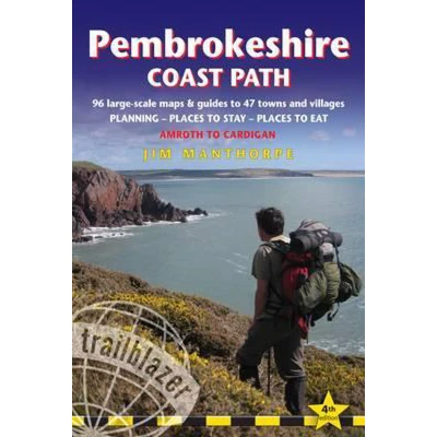
The Pembrokeshire Coast Path follows a National Trail for 186 miles (299km) around the magnificent coastline of the Pembrokeshire Coast National Park in south-west Wales.Renowned for its unspoilt sandy beaches, secluded coves, tiny fishing villages and off-shore islands rich in bird and marine life, this National Trail provides some of the best coastal walking in Britain. - Extra colour mapping – 14 stage maps (one stage per page) including trail profiles showing climbs and descents and 2 overview maps to help plan the walk - Maximum accommodation options – some modifications to starts and ends of stages to give greater choice of places to stay- Comprehensive information for tidal estuaries – full details on walking along tidal sections of the path to keep safe- Guided detours around private land eg Ministry of Defence – avoiding road walking where possible- Includes 96 walking maps – the largest-scale maps available – 12 town plans and 84 large-scale walking maps - at a scale of just under 1:20,000 (8cm or 3-1/8 inches to 1 mile) these are bigger than even the most detailed walking maps currently available in the shops.- Unique mapping features – walking times, directions, tricky junctions, places to stay, places to eat, points of interest. These are not general-purpose maps but fully-edited maps drawn by walkers for walkers.- Itineraries for all walkers – whether hiking the route in its entirety or sampling the highlights on day walks or short breaks. Includes detailed public transport information for all access points.- Practical information for all budgets – what to see, where to stay, where to eat: pubs, hotels, B&Bs, camping, bunkhouses, hostels.- Comprehensive public transport information for day walks - all access points on the path.- Flora and fauna - detailed information including 4pp colour flower section.


The Pembrokeshire Coast Path follows a National Trail for 186 miles (299km) around the magnificent coastline of the Pembrokeshire Coast National Park in south-west Wales.Renowned for its unspoilt sandy beaches, secluded coves, tiny fishing villages and off-shore islands rich in bird and marine life, this National Trail provides some of the best coastal walking in Britain. - Extra colour mapping – 14 stage maps (one stage per page) including trail profiles showing climbs and descents and 2 overview maps to help plan the walk - Maximum accommodation options – some modifications to starts and ends of stages to give greater choice of places to stay- Comprehensive information for tidal estuaries – full details on walking along tidal sections of the path to keep safe- Guided detours around private land eg Ministry of Defence – avoiding road walking where possible- Includes 96 walking maps – the largest-scale maps available – 12 town plans and 84 large-scale walking maps - at a scale of just under 1:20,000 (8cm or 3-1/8 inches to 1 mile) these are bigger than even the most detailed walking maps currently available in the shops.- Unique mapping features – walking times, directions, tricky junctions, places to stay, places to eat, points of interest. These are not general-purpose maps but fully-edited maps drawn by walkers for walkers.- Itineraries for all walkers – whether hiking the route in its entirety or sampling the highlights on day walks or short breaks. Includes detailed public transport information for all access points.- Practical information for all budgets – what to see, where to stay, where to eat: pubs, hotels, B&Bs, camping, bunkhouses, hostels.- Comprehensive public transport information for day walks - all access points on the path.- Flora and fauna - detailed information including 4pp colour flower section.
 Productspecificaties
| EAN |
|
|---|---|
| Maat |
|
 Prijshistorie
Prijzen voor het laatst bijgewerkt op:
 Gerelateerde producten
 Naar shop


