Mapping The Second World War


 Beschrijving
Bol Partner
Follow the conflict of the Second World War from 1939 to 1945 in this unique volume, published in association with Imperial War Museums, London, featuring historical maps and photographs from their archives, and fascinating commentary from an expert historian. Follow the conflict of the Second World War from 1939 to 1945 in this unique volume, published in association with Imperial War Museums, London, featuring historical maps and photographs from their archives, and fascinating commentary from an expert historian. Over 150 maps tell the story of how this global war was fought. Types of maps featured:• Strategic maps showing theatres of war, frontiers and occupied territories• Maps covering key battles and offensives on major fronts• Planning and operations maps showing defences in detail• Propaganda and educational maps for the armed forces and general public• Maps showing dispositions of Allied and enemy forces• Bomber and V-weapon target maps Descriptions of key historical events accompany the maps, giving an illustrated history of the war from an expert historian. Key topics covered include• 1939: Invasion of Poland• 1940: German invasion of Low Countries & France• 1940: Battle of Britain & German invasion threat• Dec 1941: Pearl Harbor• 1942: Turning points: Midway, Alamein, Stalingrad• 1941-45: Barbarossa and the Eastern Front• The War at Sea• The advances to Jerusalem, Damascus and Baghdad• The War in the Air• 1944: Neptune & Overlord; D-Day & liberation of France


Follow the conflict of the Second World War from 1939 to 1945 in this unique volume, published in association with Imperial War Museums, London, featuring historical maps and photographs from their archives, and fascinating commentary from an expert historian. Follow the conflict of the Second World War from 1939 to 1945 in this unique volume, published in association with Imperial War Museums, London, featuring historical maps and photographs from their archives, and fascinating commentary from an expert historian. Over 150 maps tell the story of how this global war was fought. Types of maps featured:• Strategic maps showing theatres of war, frontiers and occupied territories• Maps covering key battles and offensives on major fronts• Planning and operations maps showing defences in detail• Propaganda and educational maps for the armed forces and general public• Maps showing dispositions of Allied and enemy forces• Bomber and V-weapon target maps Descriptions of key historical events accompany the maps, giving an illustrated history of the war from an expert historian. Key topics covered include• 1939: Invasion of Poland• 1940: German invasion of Low Countries & France• 1940: Battle of Britain & German invasion threat• Dec 1941: Pearl Harbor• 1942: Turning points: Midway, Alamein, Stalingrad• 1941-45: Barbarossa and the Eastern Front• The War at Sea• The advances to Jerusalem, Damascus and Baghdad• The War in the Air• 1944: Neptune & Overlord; D-Day & liberation of France
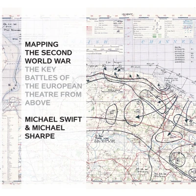
BolThe Second World War was a watershed in world history: the seizing of power by Hitler and the Nazis, the slowly building crescendo of annexations that led to Blitzkrieg, the conquest of Europe, the U-boat war, the strategic bombing campaign, the invasion of Russia, Stalingrad and D-Day, and the long German retreat to unconditional surrender. Mapping the Second World War does not try to retell every point in the story of the war in Europe, rather it seeks to provide – through contemporary documents – a different view of the war and suggest avenues for further research. Presenting over 100 maps it looks both at the broad sweep of events – such as the invasion of Europe in June 1944 – and at details – the two-man X-craft attack on the battleship Tirpitz – to provide a fascinating sample of how events during the war were mapped out. Charts and maps were vital to the conduct of the war: before each military event there was planning, the reconnaissance, the conjecture as to enemy dispositions: after the event there would be debriefing, analysis of success and failure, and a redrawing of maps to show new troop positions and boundaries. Many of the maps selected have been used in actual combat and are marked up accordingly. Such battlefield annotations add to this fascinating overview of some of the key events in the Second World War and are referenced in the extended accompanying map captions. The volume is complete with a detailed narrative introduction to the progress of the war.
 Productspecificaties
| EAN |
|
|---|---|
| Maat |
|
 Prijshistorie
Prijzen voor het laatst bijgewerkt op:
 Gerelateerde producten
 Naar shop


